CATBALOGAN CITY, Samar — In the heart of Samar, where limestone hills give way to untold underground wonders, local officials and conservation groups are working quietly but urgently to put Catbalogan on the ecotourism map—literally.
As the country marks Tourism Month this September, Catbalogan City is spotlighting its ongoing cave mapping initiative, a project that seeks to identify, document, and preserve the city’s karst formations, which could one day serve as key attractions in a growing eco-tourism circuit in Eastern Visayas.
The initiative forms part of the city’s #KahusayanKatbalogan program, a development agenda pushed by Mayor Dexter Uy. It also reflects the global theme of this year’s World Tourism Day—“Tourism and Sustainable Transformation”—which emphasizes community-driven, environmentally responsible tourism.
Mapping the Unknown
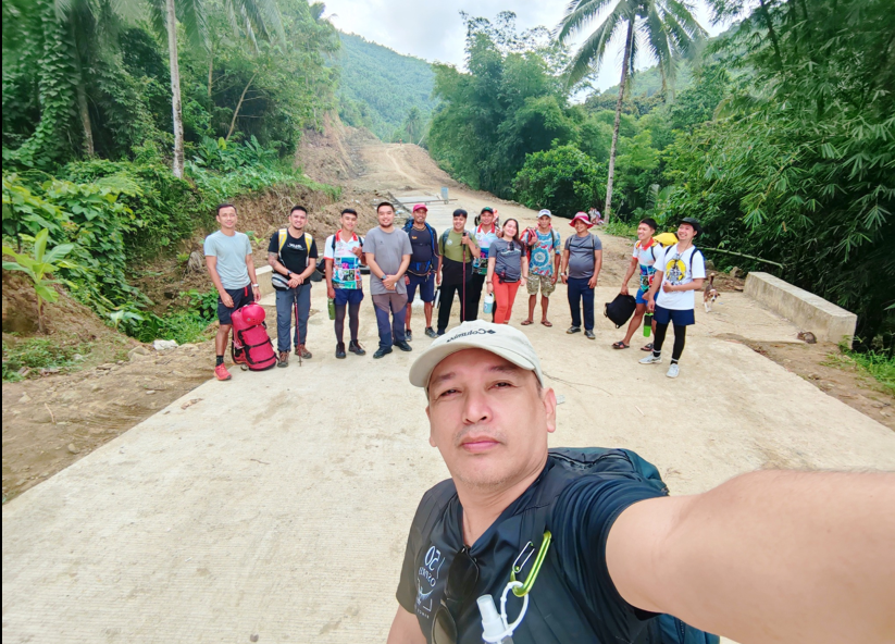
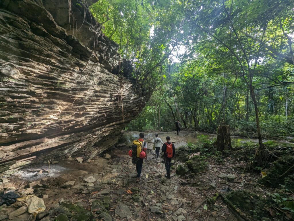
The most recent phase of the project was conducted from July 7 to 9, 2025, led by the City Tourism, Culture, Arts & Information Office (CTCAIO) in partnership with a broad coalition of local offices and outdoor groups. Among the partners were the City Disaster Risk Reduction and Management Office (CDRRMO), City Environment and Natural Resources Office (CENRO), Barangay and Community Affairs Office (CBACAO), and the Samar Mountaineering and Outdoor Club, Inc.
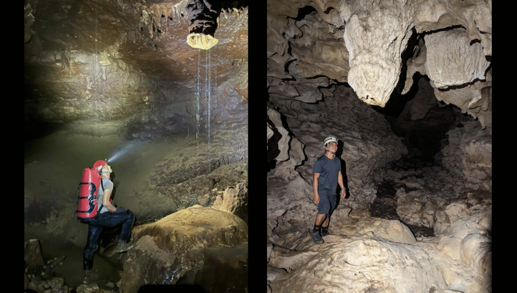
Taking the technical lead was Mikael Vincent Cuevas of the National Speleological Society (NSS), joined by members of the Philippine Cavemen, a group affiliated with the NSS and recognized under the DENR’s Cave Management Committee.
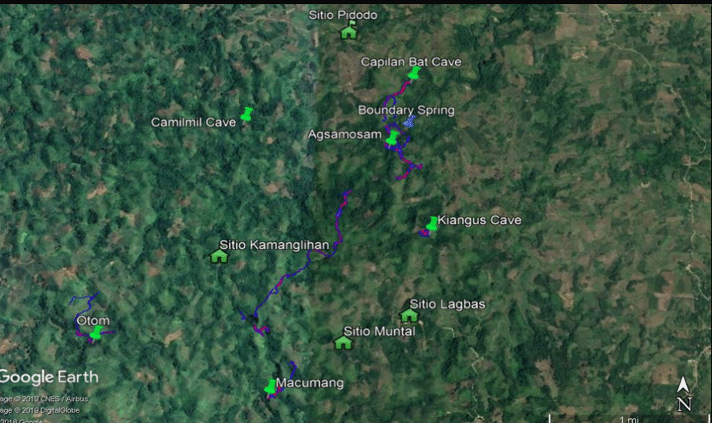
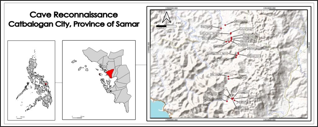
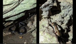
Together, the reconnaissance team was able to identify 24 karst features, including caves and sinkholes, scattered across several barangays. Of these, 18 were classified as caves, with some receiving initial assessments and basic exploration. The sites are located in Barangays San Andres, Lobo, Totoringon Centro, Cagutian, and Sitio Cabunga-an—an area that alone hosts seven cave systems.
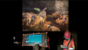
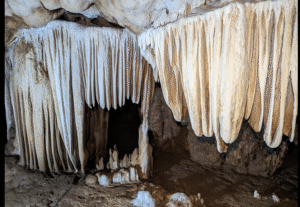
Among the notable discoveries are the Totoringon Bat Cave, Oringan Cave systems, and the Cabunga-an Sinkhole—features with significant potential for adventure tourism and biodiversity research.
Charting the Next Steps
Following the reconnaissance, the team identified six action points to move the project forward: formal cave surveying and mapping training, a series of expedition-level mapping activities, cave assessment for ecotourism viability, and skills training in basic caving techniques and single rope techniques (SRT). These are scheduled for rollout in late 2025 and into 2026.
For tourism officials, the long-term vision is not just about attracting visitors but about doing so responsibly.
“We’re mapping these caves not just to open them, but to understand how we can protect them, how we can prepare the community, and how tourism can be part of that balance,” said Ador Hurtado, head of the City Tourism, Culture, Arts and Information Office (CTCAIO). “We want locals to benefit, and we want the ecosystems to be respected.”
A Model for Sustainable Tourism
The project resonates with the larger call of this year’s Tourism Month celebration—investing in people and places for long-term resilience.

While tourism remains one of the fastest-growing sectors globally, many emerging destinations like Catbalogan still face challenges in training local communities and ensuring they have a seat at the table. By grounding this project in education, partnerships, and environmental awareness, city officials hope to build not just a tourism product, but a sustainable tourism model.
In a region long known for its rugged natural beauty, Catbalogan’s caves may soon become more than hidden gems—they may represent a new chapter in how tourism is done: slower, smarter, and with the community at its core. (Ricky J. Bautista with additional photos from Mikael Vincent Cuevas)